1/15/2020
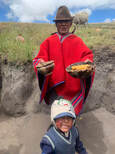
- Today we left around 8:15 for a 3-hour bus ride to Quilotoa, a water-filled caldera in the New Andes. We stopped at the house of an indigenous family on the way there, where they kindly invited us in showing how they live. Mud and grass insulates the house. Guinea pigs were running around at our feet which were to be used as food eventually. He showed us the great variety of potatoes they grew and they displayed their own handmade scarves and other textiles that were for sale.
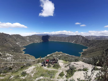
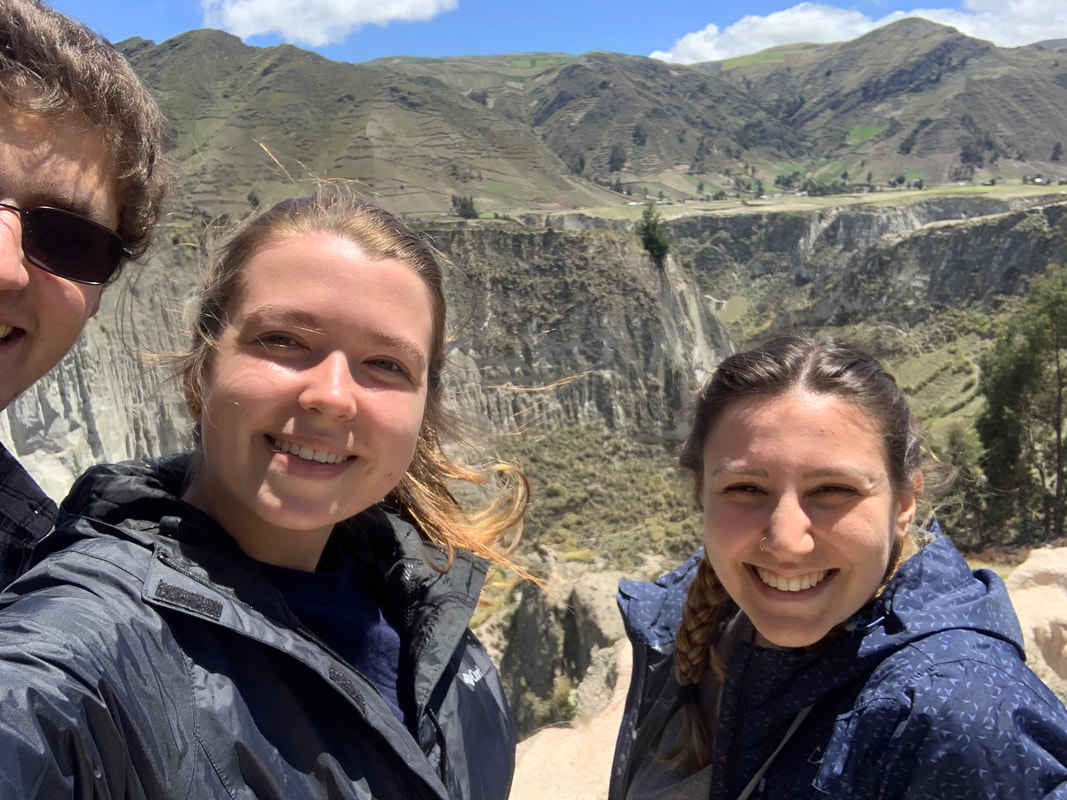
- On the way, we stopped at the Toachiriver canyon where we got out to admire the beauty. A local geologist, Theofilos Toulkeridis, from Central de Geological, Volcanologia, y Geodinamica, spoke to us on our bus ride. He discussed how Ecuador is one of most dangerous countries in respect to seismic activity The only megafault is the Guayaquil-Caracas megafault. Of the volcanoes on Ecuador, 19/150 are active on mainland with 17 deemed dormant and 2 currently active. Cotopaxi sixth most dangerous. Quilotoa formed after a massive eruption caused it to collapse in the middle and fill with water. Every year, it sinks 1 meter. There is a high percentage of CO2, therefore not allowing for swimming in the lake. Julie, Tait, and I made the quick hike down to the bottom and stayed for a bit to admire the caldera. Julie and I then made our way back up by horse but after a few minutes we realized the concept seemed abusive, so got off and hiked the steep incline ourselves, feeling proud and content at the end. After the hike, we stopped to buy some souvenirs and I bought a beautiful alpaca blanket that is one of my favorite purchases from the trip.
|
|
|
When we returned back to our hotel, Dr. Theofilos gave a presentation on Geodynamics and Volcanism. He discussed the three faults: diversion, conversion, transform. Subduction is when the oceanic plate slips under continental plate, which occurs with the denser oceanic Nazca plate as it dives below the South American plate.
Ecuador is very seismically active. Around every 100 years, there is a big earthquake in Quito. The Galapagos islands, 1000km away from the coast, are largely responsible for earthquakes and seismic activity. There is a hot spot under the islands moving all formed volcanoes away from it and leaving a chain of volcanoes in its wake.
The 2007 theory about the origin of hotspots discussed how not everything melts when a plate subducted, resulting in the dense minerals present in the plate causing it to sink. As it sinks, it begins to heat up and become viscous and causing minerals to deposit as it rises, forming a mantle plume, leading to volcanic formation.
Shield volcanoes are the biggest volcanoes. Weathering and erosion cause older islands to degrade in size. Calderas tend to form when volcanoes reach 3000m above sea level. Sagay most active volcano in Americas and Chimborazo is technically the highest spot on earth when measuring from the crust of earth to space.
Reventador is the second most active volcano and Chalupa is the ninth most dangerous on planet, emphasizing the volcanic activity of the country and serving as a reminder of the many threat volcanoes pose to the safety and security of Ecuadorians.
